THE LAYA GASA TREK

  • Days:19 Days
  • Difficulty:Moderate
  • Country:Bhutan
  • Activity:Trekking & Hiking
  • Max Altitude:5, 005 meters/16416 feet
  • Accomodation:Tea House & Lodges
  • Best Season:Mar-May, Sep-Nov
  • Meals:B,L,D
5/5 Stars form 13 reviews
Trekking & Hiking
19 Days Days Trip For

N/A

THE LAYA GASA TREK-19 Days Day/s

  • (9 Reviews)

Duration

19 Days

Days

Trip Introduction

The Laya-Gasa trek in Bhutan is an adventure that takes you to the remote and rugged regions of the Himalayas. The trek is known for its natural beauty, rich culture and challenging terrain.

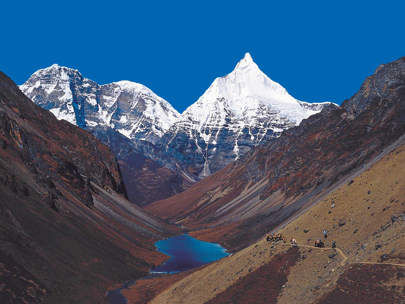
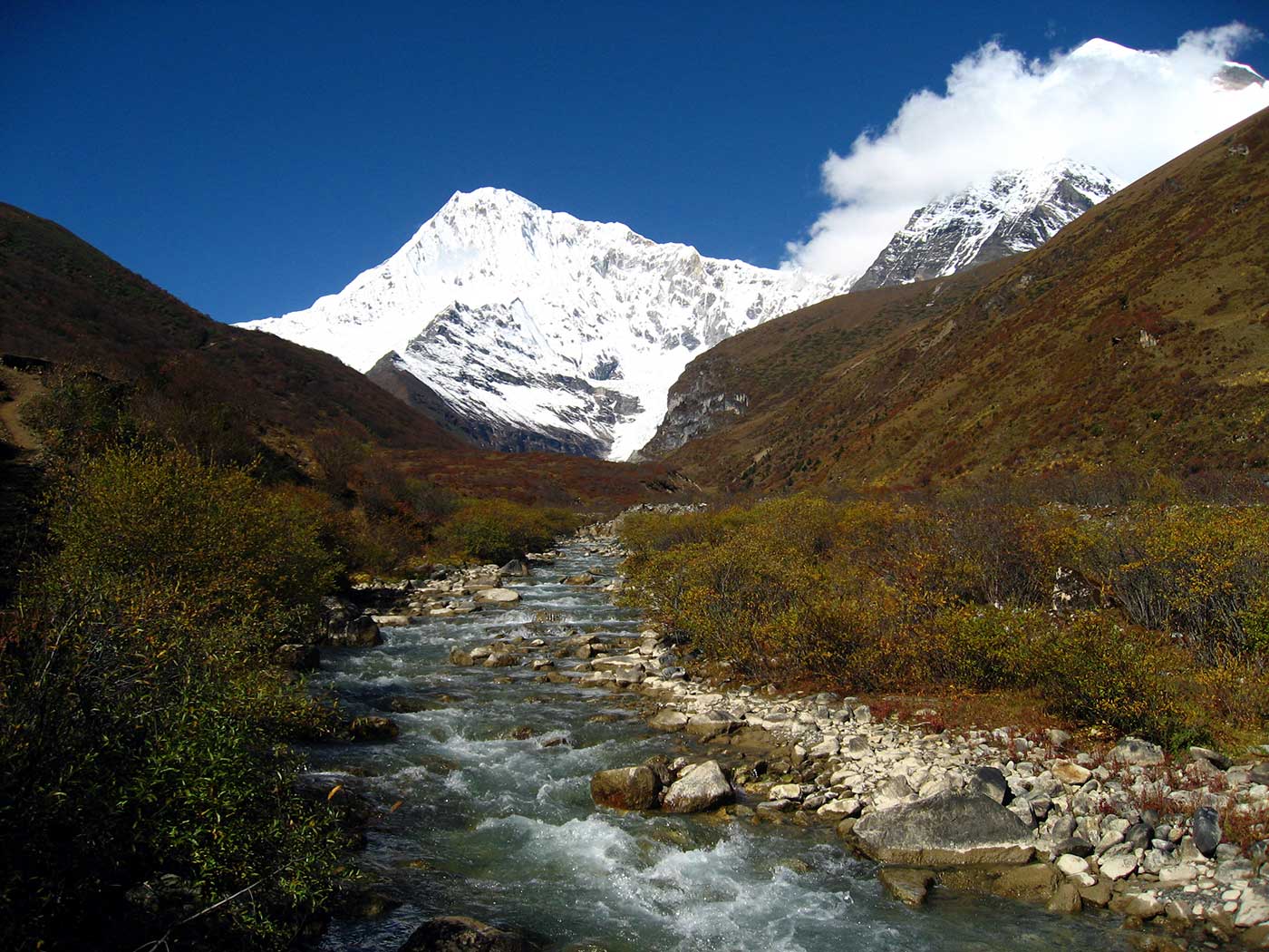
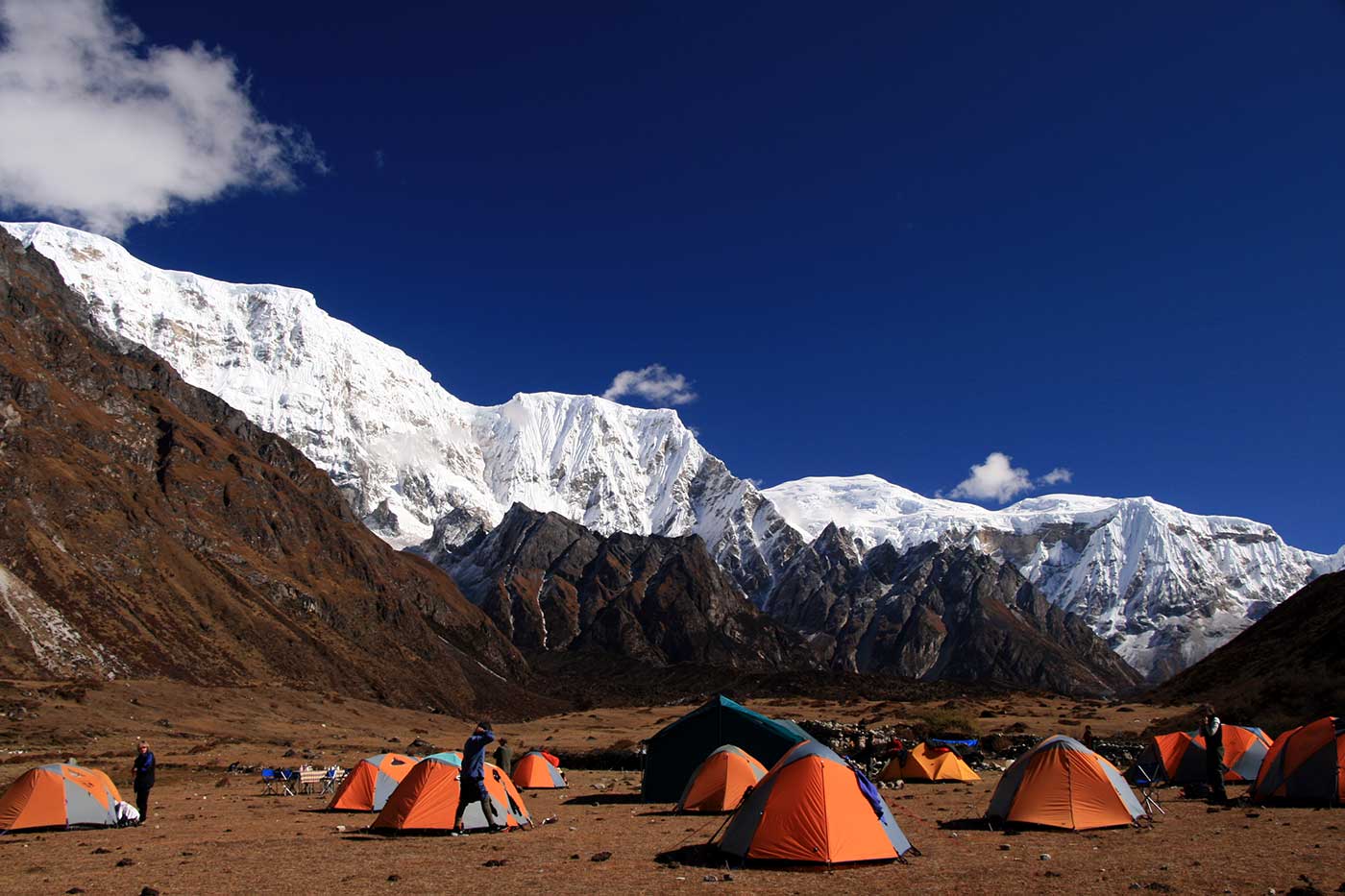
As you embark on the trek, you’ll be greeted by the lush forests and pristine rivers that carve their way through the valley. The trail takes you through small villages and traditional hamlets, where you’ll be greeted by the friendly local people and their traditional way of life. The trek takes you through a variety of landscapes, from dense rhododendron forests to barren high altitude meadows, as you gain elevation. The trail is challenging, but the rewards are well worth the effort. The views of the snow-capped peaks, including Gangkar Punsum, are truly breathtaking. The glaciers, the icefall, and the snow-covered peaks, all create a sense of awe and wonder.

Throughout the trek, you’ll also have the opportunity to experience the traditional culture and way of life of the Bhutanese people. You’ll learn about the local customs, traditions and the importance of Buddhism in daily life. You’ll also have the chance to try traditional Bhutanese cuisine and see the local art and craft. The trek also takes you through passes and passes and offers a chance to see the beautiful wildflowers and the variety of fauna that inhabit the area.

The Laya-Gasa trek is also known for its hot springs and the trekkers have an opportunity to relax in the hot pools and rejuvenate after the day’s hike.

Overall, the Laya-Gasa trek is a journey that will take you to the heart of the Bhutan’s natural and cultural wonders. It’s an opportunity to reconnect with nature, to push your limits, and to discover the beauty of one of the most remote and beautiful regions in the world. The trek is a perfect blend of adventure, culture, and scenic beauty.

Trip Highlights


  • Trek through solitary and difficult Himalayan terrain while taking in breath-blowing views of snow-capped peaks like Gangkar Punsum.
  • As you travel through small towns and traditional hamlets in Bhutan, you will get a chance to see the country’s unique culture and learn about the religion’s significance in daily life.
  • As you travel through lush forests, clean rivers, dense rhododendron forests, and arid high-altitude meadows, you will come to appreciate Bhutan’s natural splendor.
  • After a day of hiking, take a soothing swim in one of the healing hot springs that are located along the trail.
  • Witness local art and craft while experiencing the traditional Bhutanese way of life and cuisine.
  • Discover the region’s varied flora and wildflowers to make the walk the ideal fusion of adventure, culture, and natural beauty.
19 Days of walking
Pace

Terrain

Detailed Itinerary

Day 1

Bhutan, on Bhutan Airlines or Druk Air, the national airlines of Bhutan. If the weather cooperates, you might have spectacular views of four of the ten highest peaks in the world—Everest, Cho Oyu, Makalu, and Kanchenjunga—plus peaks in Bhutan such as Chomolhari, Jichu Drakye, and Tsering Kang. After meeting your trip leader or local guide at the Paro airport, we drive to our hotel overlooking the beautiful Paro Valley. We’ll have a late afternoon visit to the National Museum, housed in an old watchtower above Paro Dzong (a dzong is a fortress-monastery). The museum’s collections include displays of spectacular thangkas (religious scroll paintings), bronze statues, Bhutan’s beautiful stamps, and the Tshogshing Lhakhang (Temple of the Tree of Wisdom), with its carvings depicting the history of Buddhism. We will also visit the Paro Dzong (Rinchen Pung Dzong, meaning “fortress on a heap of jewels”), built in 1644. B,L,D…Zhiwaling Hotel


Food
Accommodation
Transportation
Trekking
Walking Hours:
,
Walking Distance:
Altitude
Elevation Gain:
,
Elevation Loss:

Day 2

We drive a few miles north from the hotel to the trailhead where we start a wonderful two-hour hike up to Taktsang Monastery (its name means “tiger’s nest”), perched on a cliff 2,700 feet above the floor of the Paro Valley. Our hike follows a steep switchback trail and serves as a great warm-up for our trek. Lunch in Paro. In the afternoon you will be free to relax. B,L,D…Zhiwaling Hotel


Food
Accommodation
Transportation
Trekking
Walking Hours:
,
Walking Distance:
Altitude
Elevation Gain:
,
Elevation Loss:

Day 3

Today we start our trek to Mount Chomolhari. Drive about 2 hours to the trailhead at Sharna Zampa (8,500’), where we’ll meet our local support staff and pack animals that will carry most of the gear. On the way we can visit the Drukyel Dzong and catch our first glimpse of Chomolhari. Upon arrival we begin our trek along the Paro River, passing traditional farming communities. We arrive at our first campsite alongside the Paro River near Shingkarab beyond Sharna Zampa after 2 hours of hiking. (~4 miles, 2 hours hiking.) B,L,D…Camp


Food
Accommodation
Transportation
Trekking
Walking Hours:
,
Walking Distance:
Altitude
Elevation Gain:
,
Elevation Loss:

Day 4

Today is a strenuous day of hiking with lots of elevation gain and loss, but it is a real confidence booster for the days ahead. We continue along the Paro River through some spectacular lush forests of oak, rhododendron, spruce, red birch, and larch. As the valley narrows the trail ascends and descends across very rocky and muddy terrain while gradually gaining altitude. As we get closer to our camp for the night, we begin to catch a glimpse of the sacred snow-capped summit of Chomolhari (if the weather is clear). After a long hard day, we camp in an old growth juniper forest at Soi Thangthangkha (11,840′). (~10.5 miles, 6-7 hours hiking.)


Food
Accommodation
Transportation
Trekking
Walking Hours:
,
Walking Distance:
Altitude
Elevation Gain:
,
Elevation Loss:

Day 5

We continue following the Paro River on a demanding, rocky trail, and then the valley widens again, opening to a spectacular area surrounded by high snow-capped ridges. A few yak-herding families are based in this area, and we may be lucky to pay them a visit and try some of their dried yak cheese. Camp at Jangothang (13,382′) below a ruined fortress near the base of Chomolhari (23,997’). (11.5 miles, 5.5-6 hours hiking.) B,L,D…Camp


Food
Accommodation
Transportation
Trekking
Walking Hours:
,
Walking Distance:
Altitude
Elevation Gain:
,
Elevation Loss:

Day 6

Today is a free day to rest and explore. You can take a beautiful optional hike to Tsophu (lake) for spectacular views of Chomolhari and Jichu Drakye (you’ll gain altitude quickly, which is good for acclimatization). You can also opt to stay at camp, take in the views, and rest for the challenging day ahead. (3 -4 hours hiking.)

B,L,D…Camp


Food
Accommodation
Transportation
Trekking
Walking Hours:
,
Walking Distance:
Altitude
Elevation Gain:
,
Elevation Loss:

Day 7

Climb steeply up to 14,661 feet and head into a glacial valley with many moraines. As we near the ridge we can see the snowy peaks of Tsering Kang (22,268′) and Jichu Drakye (22,924′). Continue up to the Nyile La at 15,980 feet (“la” means “pass”), about four hours from camp. From here the views of Chomolhari, Jichu Drakye, and Tsering Kang are spectacular (weather permitting!). We may also see Ganchey Ta (22,285′) and Masang Gang (23,500′). Descend along scree slopes to a side valley at 14,596 feet, traverse a hillside, then descend on switchbacks to another side valley. Camp at Lingzhi (13,152′), at the base of Tsering Kang and Jichu Drakye. (11 miles, 7-7.5 hours hiking.) B,L,D…Camp


Food
Accommodation
Transportation
Trekking
Walking Hours:
,
Walking Distance:
Altitude
Elevation Gain:
,
Elevation Loss:

Day 8

Today’s hike to Chebisa is very pleasant and easy along a rather flat and trail (no rock hopping and not much climbing). We’ll have some time to visit some homes in the village. (12 miles, 5-6 hours hiking.) B,L,D…Camp


Food
Accommodation
Transportation
Trekking
Walking Hours:
,
Walking Distance:
Altitude
Elevation Gain:
,
Elevation Loss:

Day 9

The trail leads through wild high pastures and across the Gobula (14,268′). Continue to Shomuthang and camp on a bench above the river, a tributary to the Mo Chu, which flows just below Gasa Tsachu (hot spring). (11 miles, 6 hours hiking.) B,L,D…Camp


Food
Accommodation
Transportation
Trekking
Walking Hours:
,
Walking Distance:
Altitude
Elevation Gain:
,
Elevation Loss:

Day 10

We get an early start and cross the Jarela pass (15,088′), then descend to Tsharijathang, the valley where Takin are often seen. Camp at Robluthang. (9 miles, 5 hours hiking.) B,L,D…Camp


Food
Accommodation
Transportation
Trekking
Walking Hours:
,
Walking Distance:
Altitude
Elevation Gain:
,
Elevation Loss:

Day 11

After crossing Shinche La pass (16,072’), we descend to Lemithang. We have now entered the Laya district, and we’ll pass some Laya villages. Camp beneath Ganchey Ta (22,285′), the Great Tiger Mountain. (12 miles, 7-8 hours hiking.) B,L,D…Camp


Food
Accommodation
Transportation
Trekking
Walking Hours:
,
Walking Distance:
Altitude
Elevation Gain:
,
Elevation Loss:

Day 12

The trail descends along a closed-in winding river valley. The trail forks, one branch going down to the river, while we’ll take the other, which stays high and leads to the west side of Laya village. Camp on a high flat bench above the east end of Laya, one of the highest villages in Bhutan. (7 miles, 3-4 hours hiking.) B,L,D…Camp


Food
Accommodation
Transportation
Trekking
Walking Hours:
,
Walking Distance:
Altitude
Elevation Gain:
,
Elevation Loss:

Day 13

Layap women wear a traditional conical bamboo hat with a spike on top. They also keep their hair long, unlike other women in Bhutan who favour close-cropped hair. Traditional dress includes black yak wool jacket and skirt. Today we’ll enjoy a day to meet and visit with the Layap in their homes or hike above our camp. B,L,D…Camp


Food
Accommodation
Transportation
Trekking
Walking Hours:
,
Walking Distance:
Altitude
Elevation Gain:
,
Elevation Loss:

Day 14

We leave Laya and head for Koena, following the trail as it winds up and down along the river valley. Along the way we enjoy views of the crashing river, feeder streams, and waterfalls. (12 miles, 7 hours hiking.) B,L,D…Camp


Food
Accommodation
Transportation
Trekking
Walking Hours:
,
Walking Distance:
Altitude
Elevation Gain:
,
Elevation Loss:

Day 15

Cross Balala pass (12,267′), and continue on a roller coaster trail up and down to our campsite near Gasa Tsachu (hot spring). We’ll have some time to visit the natural hot springs, where we can relax and take a longdeserved bath. The Tsachu is a famous place where people from all over the country come to bathe in its curative waters. There are four ponds and all have different healings powers. (9 miles, 6-7 hours hiking.) B,L,D…Camp


Food
Accommodation
Transportation
Trekking
Walking Hours:
,
Walking Distance:
Altitude
Elevation Gain:
,
Elevation Loss:

Day 16

We leave the hot springs and drive to Punakha (4-5 hours drive). Lunch in Punakha and we will visit the ancient 17th century Punakha Dzong, which is spectacularly situated at the confluence of the Mo and Phu Rivers. B,L,D…Dhensa Hotel


Food
Accommodation
Transportation
Trekking
Walking Hours:
,
Walking Distance:
Altitude
Elevation Gain:
,
Elevation Loss:

Day 17

On our drive to Thimphu, we will stop for a short hike to Chimi Lhakhang (temple), built by Lama Drukpa Kinley. Legend has it he subdued the demoness of the Dochu La with his “Magic Thunderbolt of Wisdom.” A wood effigy of the lama’s thunderbolt is preserved in the lhakhang, and childless women go to the temple to receive a wang (blessing) from the saint. We’ll then drive across the Dacha La (10,000′), marked by hundreds of colorful fluttering prayer flags, to the capital city of Thimphu. We’ll arrive around 3:30 pm and the remainder of the day is free to shop or explore on your own. B,L,D…Dusit Hotel


Food
Accommodation
Transportation
Trekking
Walking Hours:
,
Walking Distance:
Altitude
Elevation Gain:
,
Elevation Loss:

Day 18

Our sightseeing in Thimphu includes the Traditional Hospital of Herbal Medicine, Folk Heritage Museum, and the School of Arts and Crafts (or “painting school”), where Bhutanese children can follow a six-year program in traditional arts, such as drawing, painting, woodcarving, and sculpture. In the late afternoon we’ll drive two hours to Paro and enjoy a festive Farewell Dinner. B,L,D…Zhiwaling Hotel


Food
Accommodation
Transportation
Trekking
Walking Hours:
,
Walking Distance:
Altitude
Elevation Gain:
,
Elevation Loss:

Day 19

Morning transfer to the Paro airport for departure on your flight to Delhi. B


Food
Accommodation
Transportation
Trekking
Walking Hours:
,
Walking Distance:
Altitude
Elevation Gain:
,
Elevation Loss:


Join our Fixed Departure

Included


  • Arrival & Departure: Airport – Hotel transfers – Airport (Pick Up and Drop)
  • Hotel Accommodation in Bhutan : Hotel in Bhutan  on bed & breakfast Basis- Twin Bedroom
  • Permit: All necessary paper works: National Park permits & conservation entry fee
  • Insurance: Insurance for all involved Nepalese staffs during trek
  • Member transportation: Ground Transportation with Guide as per itinerary. Stuffs Transportation: Necessary all equipment Transportation for all.
  • Member Luggage:  Up to 15 Kg per member for personal baggage during the trek carrying by porters
  • Lodging & Food: Food 3 meals a day (BDL) along with accessible accommodation at Hotel/Lodge during the trek
  • Guide and Porter: 1 English speaking Guide, Porters (2 trekkers: 1 porter) during the trek
  • Staff Salary and allowance: All Nepalese staff daily wages, salary and food and accommodation
  • First Aid Kit: A well-stocked first aid kit will be available for emergencies.

Excluded


  • Airfare and Visa: International flight fares to/from Paro and Bhutan entry visa fees.
  • Personal Transportation: Any personal transportation beyond the aforementioned programs.
  • Lunch and Dinner: Lunch and dinner in Paro and during early returns from the trek.
  • Extra Night in Bhutan : Any extra nights’ accommodation in Bhutan  due to early arrivals, late departures, or early returns from the trek.
  • Rescue Evacuation: Medical insurance and emergency rescue evacuation costs if required, including rescue, repatriation, medication, medical tests, and hospitalization costs.
  • Personal Expenses: Telephone, internet, battery recharge, shower, laundry, alcoholic beverages, boiled water, beer, coke, and personal trekking gear and equipment.
  • Tips: Tips for guides, porters, and staff.

Note: Any other services not mentioned in the included or excluded services list will not be covered and will be the responsibility of the trekker.

Guides

Route Map


Altitude Map

Accommodations

FAQ

Go On 19 Days Trip For

Price From

$11,000

/ person
Group Trip
Speak To an Expert